Watershed Resource Mapping Program
Richmond Regional Watershed Platform
The interconnectedness of the Richmond region is evident in its watersheds. Although watersheds play an important role in the region, many do not know what they are, what they do, or their impact on water quality. Through a grant from the Department of Environmental Quality (DEQ), PlanRVA has created a watershed resource platform to increase regional awareness. This interactive map offers relevant information and available resources to ensure that all residents understand the function and purpose of a watershed.
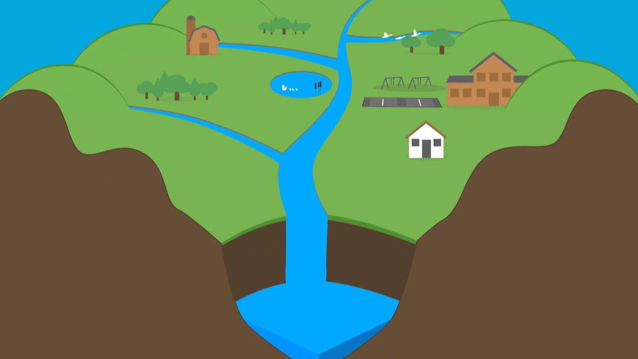
A watershed is the land and area that drains both rainfall and snowmelt into a larger body of water, such as a stream, river, or lake. Watersheds vary in size and their boundaries are determined by the shape and features of the land's surface. For example, because water drains downhill, high points (i.e., hills or ridges) define the boundaries of a watershed. All bodies of water in Virginia, from streams to rivers, have a watershed and all residents live in one.
Source: Connecticut River Conservancy
To explore our mapping program and learn more about your local watershed, please click here.

Check out this interactive map that shows the path of a raindrop in your watershed here.
Chesapeake Bay Act:
The efforts of the Chesapeake Bay Preservation Act improve water quality in the Chesapeake Bay watershed. To learn more click here.
Watershed Resources

This project, Task # 48 was funded by the Virginia Coastal Zone Management Program led by the Virginia Department of Environmental Quality through Grant FY18 #NA18NOS4190152 of the US Department of Commerce, National Oceanic, and Atmospheric Administration, under the Coastal Zone Management Act of 1972, as amended. The views expressed herein are those of the authors and do not necessarily reflect the views of the US Department of Commerce, NOAA, or any of its sub-agencies.
