Hazard Mitigation
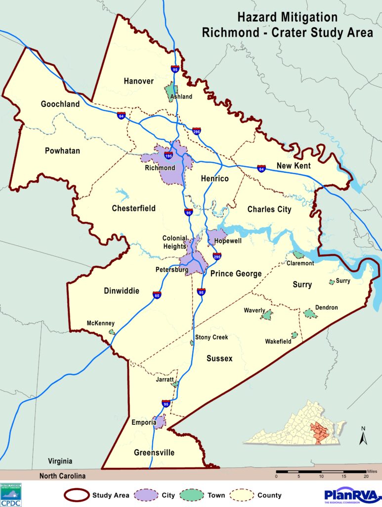
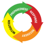
Hazard mitigation planning is a process undertaken to reduce loss of life and property by lessening the potential impact of future disasters. The 22 localities of the Richmond and Crater regions work together to update the Richmond-Crater Multi-Regional Hazard Mitigation Plan every five years. The 2022 Richmond-Crater Multi-Region Hazard Mitigation Plan is a tool to increase public awareness about local hazards and risks by providing information on the resources available to reduce those risks. A draft plan was finalized and approved by the Virginia Department of Emergency Management and FEMA in late summer 2022. Localities in the Richmond and Crater regions began adopting the plan in August 2022.
The region is vulnerable to a wide range of hazards that threaten the safety of residents and have the potential to damage or destroy both public and private property and disrupt the local economy and overall quality of life. While the threat from hazards may never be fully eliminated, the Richmond-Crater Multi-Region Hazard Mitigation Plan recommends specific actions designed to protect residents, business owners and the built environment.
FEMA Approved Hazard Mitigation Plan
Public Meeting 1
Public Meeting 2
Regional Technical Committee Workshops
Hazard Mitigation Planning Process
Several elements of the mitigation planning process are critical to preparing a plan that successfully accomplishes a community’s mitigation goals.
Public Involvement
Public awareness is a key component of an overall mitigation strategy aimed at making a home, neighborhood, school, business or city safer from the effects of natural hazards.
Public input was initially sought using three primary methods:
(1) open public meetings advertised locally;
(2) broadly-distributed public survey; and,
(3) the posting of the draft Hazard Mitigation Plan on each PDC’s web site.
Hazard Identification and Risk Assessment
A critical element of any hazard mitigation plan is the Hazard Identification and Risk Assessment (HIRA). The HIRA is used to identify the hazards that could affect the planning regions. In response to hazard-specific vulnerability levels; mitigation strategies, activities and projects can be developed to minimize hazard risks. The HIRA identifies each hazard which was assessed for three new components of risk: 1) social vulnerability; 2) impacts of climate change; and 3) mass evacuation impacts.
The hazards determined to be regional risks include:
Flooding
Flooding due to Impoundment Failure
Severe Wind Events
Tornadoes
Wildfires
Severe Winter Weather
Thunderstorms (including Hail & Lightning)
Droughts and Extreme Heat
Earthquakes
Landslides
Shoreline Erosion
Sinkholes
Radon Exposure
Capability Assessment
The capability assessment involves an evaluation of the current capacity of each community in the Region to mitigate the effects of the natural hazards identified in the HIRA. Careful examination of local capabilities helps detect existing gaps, and/or weaknesses within ongoing government activities that could hinder proposed mitigation activities. This assessment also highlights local jurisdictions within the Richmond-Crater region that have had numerous successes with mitigation actions that reduce vulnerability from a variety of hazard.
Mitigation Strategy
Development of the mitigation strategy portion of the plan builds on the previous parts of the process to develop the final two components:
1) Mitigation goals that will serve as the guiding principles for future mitigation policy and projects; and
2) Proposed mitigation actions.
Mitigation goals represent broad statements that are achieved through the implementation of more specific, action-oriented tasks listed in the mitigation action plan.
Mitigation Actions include both hazard mitigation policies (such as the regulation of land in known hazard areas), and hazard mitigation projects that seek to address specifically targeted at-risk properties (such as the acquisition and relocation of flood-prone structures).
Hazard Mitigation Planning Process
Mitigation Actions are regional specific strategies presented in the plan based upon the level of hazard and cost contingencies. Each mitigation action is location specific relative to regional or county initiative. Benefit costs are examined in the plan to determine concrete examples as to how a mitigation action may benefit a regional area.
Mitigation Action Examples:
- Strengthen regional strategy for incoming evacuees, to include plan development, traffic management, sheltering, and information sharing.
- Integrate mitigation goals and actions into other regional planning mechanisms, for example regional economic development, resiliency, transportation, parks and trail, and watershed plans.
- Address and investigate significant and high hazard region-wide dam safety for possible classification and address necessary retrofit/repairs. This inspection detail will include outreach to private dam owners on current data and encourage public awareness through signage and media.
FEMA maintains this data and has been updated since this plan.
If you want to learn more, follow this link: Map | National Risk Index (fema.gov)
With the guidance of FEMA, PlanRVA and Crater-PDC developed this Hazard Mitigation Plan to identify vulnerabilities associated with a variety of hazards and sets out long-term strategies to reduce or eliminate risks. The PDCs would like to acknowledge the contributions of Salter’s Creek Consulting, Inc., Hampton, Virginia, and Wood throughout the planning process, and contributions of members of Steering Committee.


