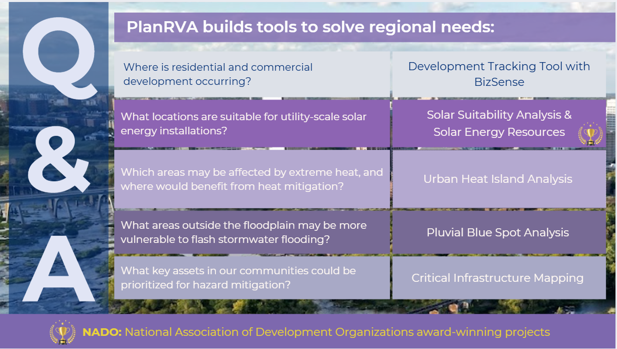
PlanRVA Builds Tools to Solve for Regional Needs.

Our work is, in large part, driven by the desire to respond to questions that delve deeply into challenges faced by residents, and critical issues affecting our environment and the future sustainability as a region.
We are proud of the tools we build to help the region better understand and navigate these complex issues. Below is a example of the ways PlanRVA has worked to address the questions that could be posed by an individual, group or locality in the region and beyond. Several of these tools and analyses are created and/or maintained in collaboration with partner organizations.
Three of the tools mentioned below were recognized for their impact as NADO award winning projects in 2024.
- WORTH (Wealth Opportunities Realized through Homeownership).
- Evaluation and Impact Assessment of Virginia’s REVIVE! First Responder Training Program.
- Solar Suitability Tool.

Housing:
Development Tracking Tool with BizSense
PlanRVA Day 2024 Presentation
Board_Presentation_Regional_Indicators_2023_SA_v2-1-compressed
Environment:
Extreme heat is a significant natural hazard in our region, disproportionately affecting communities of color and low-income communities. The urban heat island (UHI) effect, where urban areas experience higher temperatures than their rural surroundings, exacerbates this issue. As climate change progresses, average summertime temperatures are projected to increase, making it crucial to address this challenge proactively. This analysis identified areas within the Richmond region where the UHI effect is particularly pronounced and where opportunities for mitigating this heat are highest.
By understanding where extreme heat impacts are most severe, we can better prioritize our efforts to improve cooling capacities in those areas.
For more information about this analysis, contact Nicole Keller, Resilience Planner, at nkeller@planrva.org.
Pluvial Blue Spot Analysis
Pluvial (Surface Water) Flooding is caused when the ground is over-saturated and/or drainage systems overflow and the excess water cannot be absorbed or drained away.
While PlanRVA has had resources for mapping traditional flood zones associated with rivers and streams - Flood Risk | Plan RVA - this analysis was able to examine potential areas that might experience stormwater flooding in neighborhoods outside of flood zones.
For more information about this analysis, contact Nicole Keller, Resilience Planner, at nkeller@planrva.org.
This project was made possible by NASA resources.
Emergency Management:
Critical Infrastructure Mapping
Critical Infrastructure in the Richmond Region is considered assets, systems and networks, whether physical or virtual that, if destroyed, impaired, or made inaccessible by natural disaster or attack, would significantly disrupt the functioning of society or endanger the safety of people.
Critical Infrastructure includes public and private assets at multiple scales (such as federal/state, regional, and local). These are assets that should be prioritized for resilience improvements ahead of disaster and prioritized for recovery after a disaster.
This analysis maps critical infrastructure assets in the region for use in future hazard mitigation planning and other efforts to assess risks to these assets.
For more information about this analysis, contact Ellen Cook, Project Manager, at ecook@planrva.org.